
Your data remains only in this browser.

My local profile

0Favorites0Visited0Want to visit0My itineraries

Preferences

Topics you are interested in

Recommended for you

Destinations related to your interests that you have not marked yet.

♡ Favorites

    ✓ Visited

      + Want to visit

          Take your profile to another device

          Download a JSON copy or import one created by Costa Rica Hub.

          This profile does not create an account, is not sent to Costa Rica Hub and may disappear if you clear browser data.

          Costa Rica Hub

          Search Costa Rica Hub

          Enter at least 2 characters to search guides, destinations, tools and articles.

            Province of Costa Rica

            Cartago

            Religious heritage, volcanoes and agricultural valleys

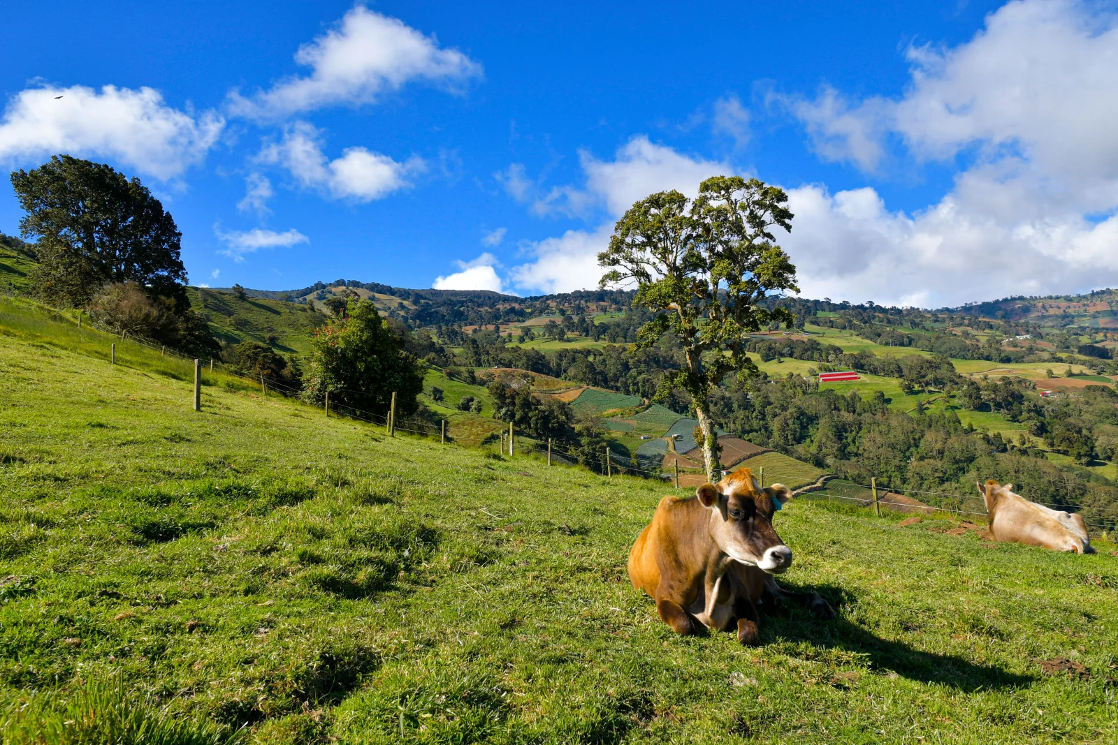
            Cartago was Costa Rica’s colonial capital and preserves some of the country’s most important religious and historical symbols. The province also contains Irazú and Turrialba volcanoes, Orosi Valley, highland farming towns and corridors toward the Caribbean and Talamanca.

            Provincial capital
            Cartago
            Geographic area
            Eastern Central Valley and Talamanca Range
            Best for
            History, pilgrimage, volcanoes, archaeology, coffee and farming towns.
            Add to itinerary
            Cartago, Costa Rica

            Understanding the province

            History and identity

            The Basilica of Our Lady of the Angels and the August pilgrimage shape national identity, while ruins, churches and estates tell colonial and republican stories. Turrialba has its own identity tied to railways, farming, cheese, archaeology and rivers.

            Landscape and territory

            The north rises into cold, fertile volcanic soils planted with potatoes, onions and vegetables. Orosi and Ujarrás form green valleys crossed by rivers and coffee. To the east lie Turrialba massif, wet forest and entrances to the Talamanca Range.

            Climate

            Cartago is cooler and windier than much of the Central Valley. Irazú and high towns can be cold, while Orosi and Turrialba are warmer and wetter. Caribbean influence can bring rain even during relatively dry Pacific months.

            Getting around

            Train and bus services connect Cartago with San José. Irazú, Orosi and Turrialba lie in different directions and work better as separate days or circuits. Route 2 can be congested at peak hours.

            Starting itinerary

            Cities and towns to start with

            This initial selection combines capitals, regional centres and representative towns. It is not a list of every canton or district.

            01

            Historic provincial capital

            Cartago

            The Basilica, parish ruins and public buildings form a compact circuit. Traffic, services and availability change during pilgrimage season.

            02

            Gateway to historic valleys

            Paraíso and Ujarrás

            Paraíso connects Lankester Botanical Garden, Ujarrás ruins and Cachí reservoir. Think of it as a corridor rather than one attraction.

            03

            Valley town

            Orosi

            Historic church, coffee, river and mountains create a quiet base for Tapantí and the valley. The scenic road can be busy on weekends.

            04

            Regional city

            Turrialba

            Eastern Cartago’s service centre, known for cheese, farming and access to Guayabo, the Pacuare and its namesake volcano.

            05

            Highland farming towns

            Pacayas and Tierra Blanca

            Cold-weather communities among crops and volcanic landscapes, well placed for observing rural life en route to Irazú or Turrialba.

            06

            Western urban centre

            Tres Ríos

            Part of the metropolitan area and Cartago’s western gateway, with coffee heritage still visible despite significant urban growth.

            Location

            Location on the map

            Use the map as a reference to identify the area and plan your journey.

            Open in Google Maps ↗

            Google Maps is an external service. The map loads only after you choose to show it, and Google may receive technical connection data.

            Important: The marker is a geographic reference. Check the route, access and current conditions before travelling.

            Before you go

            Planning advice

            1. Reserve Irazú Craters and Irazú Prusia separately and check last-entry times.
            2. Avoid squeezing Irazú, Orosi and Turrialba into one rushed day.
            3. Around the August 1–2 pilgrimage, check road closures and special transport.
            4. Carry warm layers and sun protection in the highlands even after a clear start in Cartago.

            Important: Distances, transport, weather and access conditions can change. Confirm schedules and routes close to your travel date.