
Your data remains only in this browser.

My local profile

0Favorites0Visited0Want to visit0My itineraries

Preferences

Topics you are interested in

Recommended for you

Destinations related to your interests that you have not marked yet.

♡ Favorites

    ✓ Visited

      + Want to visit

          Take your profile to another device

          Download a JSON copy or import one created by Costa Rica Hub.

          This profile does not create an account, is not sent to Costa Rica Hub and may disappear if you clear browser data.

          Costa Rica Hub

          Search Costa Rica Hub

          Enter at least 2 characters to search guides, destinations, tools and articles.

            Province of Costa Rica

            Puntarenas

            Ports, peninsulas, cloud forest and the South Pacific

            Puntarenas is Costa Rica’s largest and most geographically dispersed province. It includes the port city on the Gulf of Nicoya, Monteverde, the Central Pacific, parts of the Nicoya Peninsula, Quepos, Osa, Golfito and offshore territory such as Cocos Island.

            Provincial capital
            Puntarenas
            Geographic area
            Central and South Pacific, Nicoya Peninsula and Cocos Island
            Best for
            Coast, ports, surf, cloud forest, wildlife, peninsulas and nature travel.
            Add to itinerary
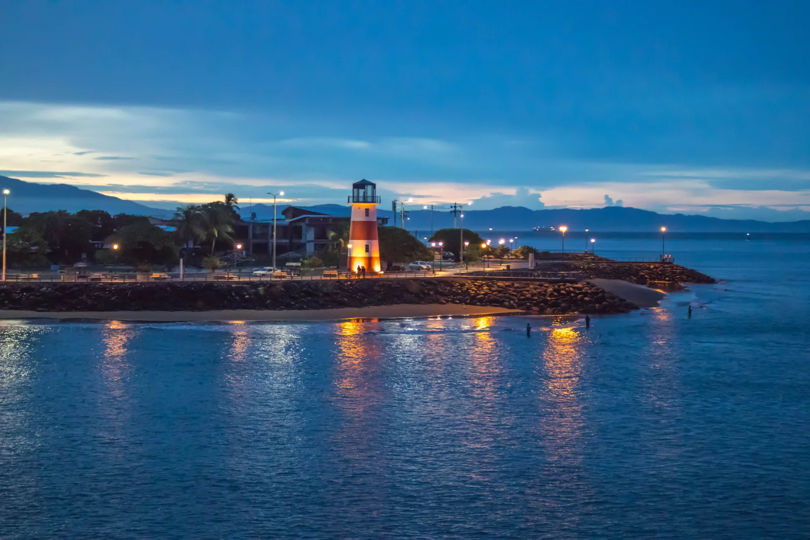
            Puntarenas, Costa Rica

            Understanding the province

            History and identity

            Port life, fishing, ferries and Paseo de los Turistas define the capital. Other areas have very different identities: Quaker history and conservation in Monteverde, coastal tourism in Jacó and Quepos, and deep relationships with forest and sea in Osa and Golfito.

            Landscape and territory

            The province contains mangroves, cloud forest, beaches, islands, Pacific rainforest and one of the planet’s great biodiversity regions in Osa. Its long shape explains why two places in Puntarenas can be many hours apart.

            Climate

            The Central and South Pacific are warm and humid, with particularly heavy southern rainfall. Monteverde is cool, windy and foggy. Wet-season conditions can affect fords, peninsula roads, boat travel and park access.

            Getting around

            Puntarenas city is the ferry hub for Paquera and Naranjo. Route 27 links San José and the coastal highway follows much of the Pacific, but Monteverde, the peninsula and Osa require major detours. Domestic flights and boats can save time in the south.

            Starting itinerary

            Cities and towns to start with

            This initial selection combines capitals, regional centres and representative towns. It is not a list of every canton or district.

            01

            Provincial capital and port

            Puntarenas

            The waterfront, market, food and ferry terminal summarize its port character. It is a stop and transport node, not the closest base for the entire province.

            02

            Coastal city

            Jacó

            Beach, surf, nightlife and services within relatively easy reach of San José. It also serves Carara, Herradura and the Central Pacific.

            03

            Tourism port city

            Quepos

            A service centre and marina beside Manuel Antonio. Town, national park and hotel zone are distinct areas connected by a busy road.

            04

            Mountain community

            Santa Elena and Monteverde

            Cloud forest, research, farms and adventure tourism. Elevation and mountain roads contrast with coastal Puntarenas.

            05

            Nicoya Peninsula

            Cóbano, Montezuma and Santa Teresa

            Cóbano organizes services and connections, while Montezuma and Santa Teresa offer different coastal experiences. Ferries, dust and rain shape transfers.

            06

            South Pacific centres

            Golfito and Puerto Jiménez

            Golfito faces Golfo Dulce and retains banana-era history; Puerto Jiménez is the main eastern base for Osa and sectors of Corcovado.

            Location

            Location on the map

            Use the map as a reference to identify the area and plan your journey.

            Open in Google Maps ↗

            Google Maps is an external service. The map loads only after you choose to show it, and Google may receive technical connection data.

            Important: The marker is a geographic reference. Check the route, access and current conditions before travelling.

            Before you go

            Planning advice

            1. Choose one subregion; crossing all of Puntarenas in a few days creates more driving than experience.
            2. Check ferry schedules and ticket procedures before reaching the dock.
            3. Reserve Corcovado early and use any required authorized services.
            4. During the wet season, ask about rivers, roads and boat conditions on the day.

            Important: Distances, transport, weather and access conditions can change. Confirm schedules and routes close to your travel date.