
Planning data
Practical visit facts
- Route or distance
- Long, flat bay; choose a short stroll or several sectors.
- Suggested time
- Half or full day.
- Admission and booking
- Public access; water activities and parking are separate services.
- Available facilities
- One of the best-served beach towns in this selection.
Distances, hours, access and facilities may change because of weather, maintenance or operating decisions. Always confirm with the official source before leaving.
Content reviewed on July 28, 2026What you will find
- Compact town with restaurants, lodging and operators.
- Long bay walks and views toward Chora Island.
- Introductory surfing, kayaking or sailing with suitable conditions and guidance.
How to plan the visit
- Ask about currents and recommended areas before entering the water.
- For kayaking or Chora Island, hire suitable equipment and guidance.
- Consider nearby Carrillo for a less developed setting.
Access and transport
A paved road approaches from Nicoya. Buses connect with San José and regional hubs, but timetables must be confirmed with operators.
Services and infrastructure
Sámara has supermarkets, restaurants, lodging, pharmacies and activities. Pavement and accessibility vary by street and beach entrance.
Season and climate
December–April is generally dry and busy. The green season brings lush vegetation and frequent afternoon rain.
Sea, tides and safety
“Moderate surf” does not mean safe water. Supervise children, avoid river mouths and follow local current warnings.
Sea conditions can change rapidly. Local information, lifeguards, park rangers and official closures always take precedence.Responsible visit
Do not stand on reef formations or remove organisms. Reduce plastic and prefer operators who remove activity waste.
Is this beach right for you?
Sámara is an easy base for families and car-free stays. The bay may moderate surf in places, but “family-friendly” never guarantees safe water.
How to understand this destination
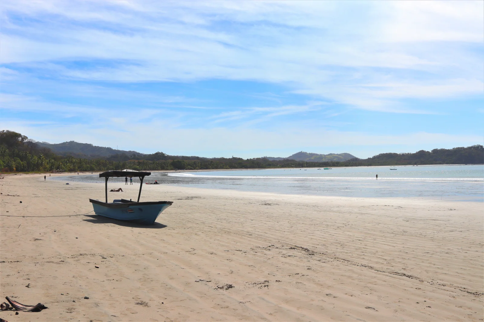
Sámara Bay extends roughly four kilometres. Its curve, reefs and Chora Island alter the seascape, but they do not turn the entire coast into a protected pool.
The town reaches close to the sand and supports a car-free stay. That convenience also creates variation: the centre is active, while the ends feel more open, have fewer immediate services and require a fresh sea assessment.
Practical stay plan
- Suggested time
- Allow 3–5 nights for bay, town and a nearby outing; one day covers the centre and part of the shore.
- Where to base yourself
- The centre works well without a car because beach, food and services cluster together. Check the lodging’s real location because “Sámara” can include surrounding areas.
- Getting around
- Walk within the core; use taxi, bus or vehicle for Carrillo and other points. Cycle only with good visibility and road care.
- A workable pace
- Water activity early, shade during peak heat and a bay walk as the sun drops.
Sectors and important differences
Walkable centre
Services sit near the beach, though pedestrians, bicycles and vehicles share narrow space.
Chora Island
Visible does not mean easy to reach. Kayak only with lifejacket, suitable weather and responsible operator.
Carrillo
A more scenic, less urban alternative with fewer immediate services and a transport need.
What to combine nearby
Playa Carrillo
Nearby but less urban. Carry what you need and decide on return transport before settling in.
Chora Island
Do not improvise the crossing. Wind, surf and fitness govern kayaking or boating; use a lifejacket and suitable operator.
Nicoya inland
A cultural or food-focused day prevents reducing the peninsula to beaches alone.
Mistakes to avoid
- Leaving children unsupervised in water.
- Crossing to Chora without checking return wind.
- Expecting uniform pavements and accessibility.
A realistic day
- Morning: sea assessment and guided activity.
- Midday: food and rest in town.
- Afternoon: bay or short Carrillo visit.
Frequently asked questions
Is Sámara suitable for families?
Logistics are convenient and some sectors may have moderate surf, but children still need constant supervision and a daily sea assessment.
Is a rental car necessary?
Not for a central stay. It helps with Carrillo and outings, while buses and identifiable transfers cover some routes.
How long is the beach?
ICT describes a bay of about four kilometres, enough distance for sectors to look and behave differently.
Official sources and further reading
Editorial verification: Reviewed 2 August 2026. Ask about currents and water operations on the day.