
History and context
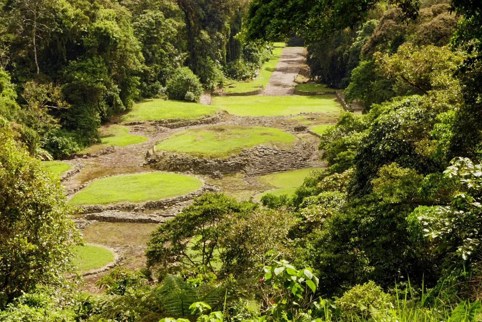
Evidence points to a long occupation, approximately from 1000 BCE to 1400 CE. Across different phases, residents built house mounds, plazas, stone-paved roads, stairways, tombs and aqueducts. The settlement was abandoned before or around European contact, and many questions about its inhabitants remain unanswered.
Why this place matters
The site’s importance lies not in one monument but in the relationship among roads, platforms, water capture and territorial planning. It demonstrates advanced construction and hydraulic knowledge while challenging the notion that Costa Rica’s pre-Columbian past lacked complex centres.
What to notice during your visit
- The Caragra causeway and other paved routes linking the settlement to its surroundings.
- Circular mounds that supported dwellings and buildings of different status.
- The aqueduct and channels, still essential to understanding the site’s engineering.
- The forest surrounding the structures, a reminder that the monument is also a protected area.
How to plan your visit
- Check SINAC for ticket availability, trail conditions and current visitor rules.
- Wear shoes with grip because stone, roots and rain can make the route slippery.
- Carry rain protection and allow time for the introductory exhibition or interpretation.
- Stay on trails and never walk over mounds or archaeological structures.
Access and location
Road access leads to Santa Teresita de Turrialba. The final mountain route can be affected by heavy rain, so review road conditions and leave ample travel time.
Conservation and responsible visits
Do not touch, move or stack stones; even a small alteration damages archaeological context. Keep food away from structures, carry out all waste and respect both heritage and forest wildlife.
Keys to interpreting the site
What does water reveal about the organization of this pre-Columbian society?
Hydraulic engineering
Aqueducts, drains and catchments show collective planning and terrain knowledge; they are not secondary to the mounds.
Connected territory
Roads, plazas and platforms organized movement, homes and public space within a settlement linked to regional routes.
Open questions
We do not know with certainty what its residents called themselves or every cause of abandonment. Responsible interpretation separates evidence from hypotheses.
Suggested visit sequence
- 01
Begin at the visitor centre to understand terms and chronology.
- 02
On the circuit, follow the relationship among road, mounds, plazas and water system.
- 03
Finish with the landscape: archaeology extends beyond visible structures.
How to combine this visit
Use Turrialba as a base, give Guayabo a full morning and add agricultural or railway heritage later without rushing the monument.