
History and context
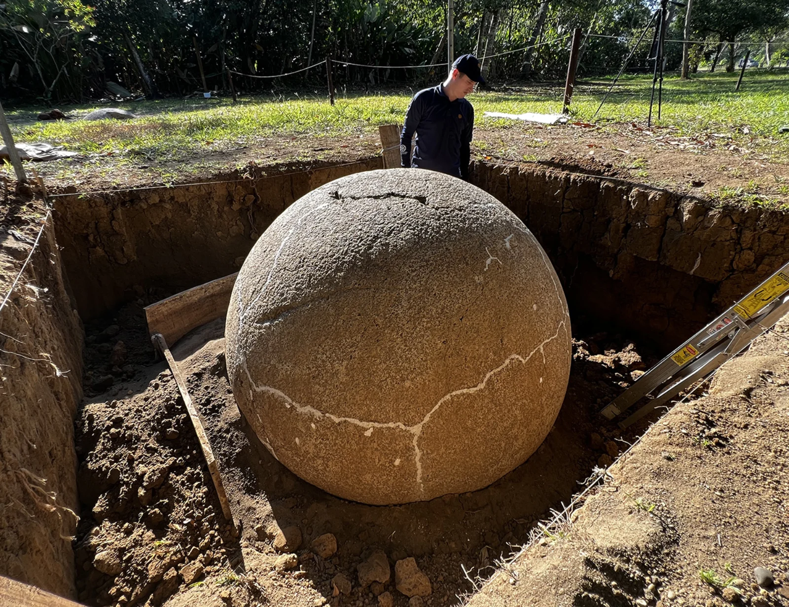
The four Diquís sites inscribed by UNESCO in 2014 preserve evidence of chiefdom societies that developed approximately between 500 and 1500 CE. Finca 6 includes mounds, paved areas and spheres, among them pieces that remain aligned and positioned in relation to the settlement.
Why this place matters
The spheres are remarkable for their craftsmanship, size and social meaning, but the site’s outstanding value depends on context. Their location in relation to homes, public spaces and routes offers evidence of power, identity and territorial organization that would disappear if they were viewed only as sculptures.
What to notice during your visit
- Spheres remaining in situ and preserved alignments within the archaeological landscape.
- Mounds and settlement areas that place the objects within community life.
- The National Museum exhibition explaining sphere production, use and research.
- The vegetation and humidity of the delta, essential factors in the site’s history and conservation.
How to plan your visit
- Check entry conditions and possible seasonal closures with the National Museum.
- Carry water, insect repellent, a hat and rain protection for the hot, humid outdoor route.
- Visit the museum before the trail to interpret the exterior evidence more clearly.
- Never touch the spheres or leave the established route.
Access and location
The site is in Palmar Sur along the road towards Sierpe. Confirm signage and directions before travelling, especially when combining the visit with boat transport or a long South Pacific itinerary.
Conservation and responsible visits
Do not climb mounds or touch and move the spheres. The position of every element is part of the scientific evidence; remain on trails and introduce no waste, plants or materials.
Keys to interpreting the site
What changes when spheres are seen in archaeological position?
Context before object
Alignments, mounds and paved areas preserve social relationships that a sphere moved to a garden no longer holds.
Diquís landscape
Rivers, the alluvial plain and mobility routes helped structure settlements and chiefdom connections.
Living heritage
Interpretation should recognize Indigenous knowledge and present communities rather than framing the spheres as an authorless mystery.
Suggested visit sequence
- 01
Begin with the exhibition to understand chronology, manufacture and the UNESCO sites.
- 02
Walk the outdoor circuit, relating spheres to mounds and occupied spaces.
- 03
Finish by separating archaeological evidence, interpretation and unproven theories.
How to combine this visit
Palmar Sur is the natural base; confirm access and management before adding other Diquís sites because they do not all operate like Finca 6.