
Planning data
Practical visit facts
- Route or distance
- There is no single public crater route; choose an identifiable geothermal experience or private trail.
- Suggested time
- Half a day for hot springs or hornillas; a full day when adding a hike.
- Admission and booking
- Book and request the exact location, distance and difficulty; do not enter farms or ICE facilities.
- Available facilities
- Facilities, surfaces and accessibility depend on the booked property.
Distances, hours, access and facilities may change because of weather, maintenance or operating decisions. Always confirm with the official source before leaving.
Content reviewed on July 28, 2026Practical decision
Is it right for your trip?
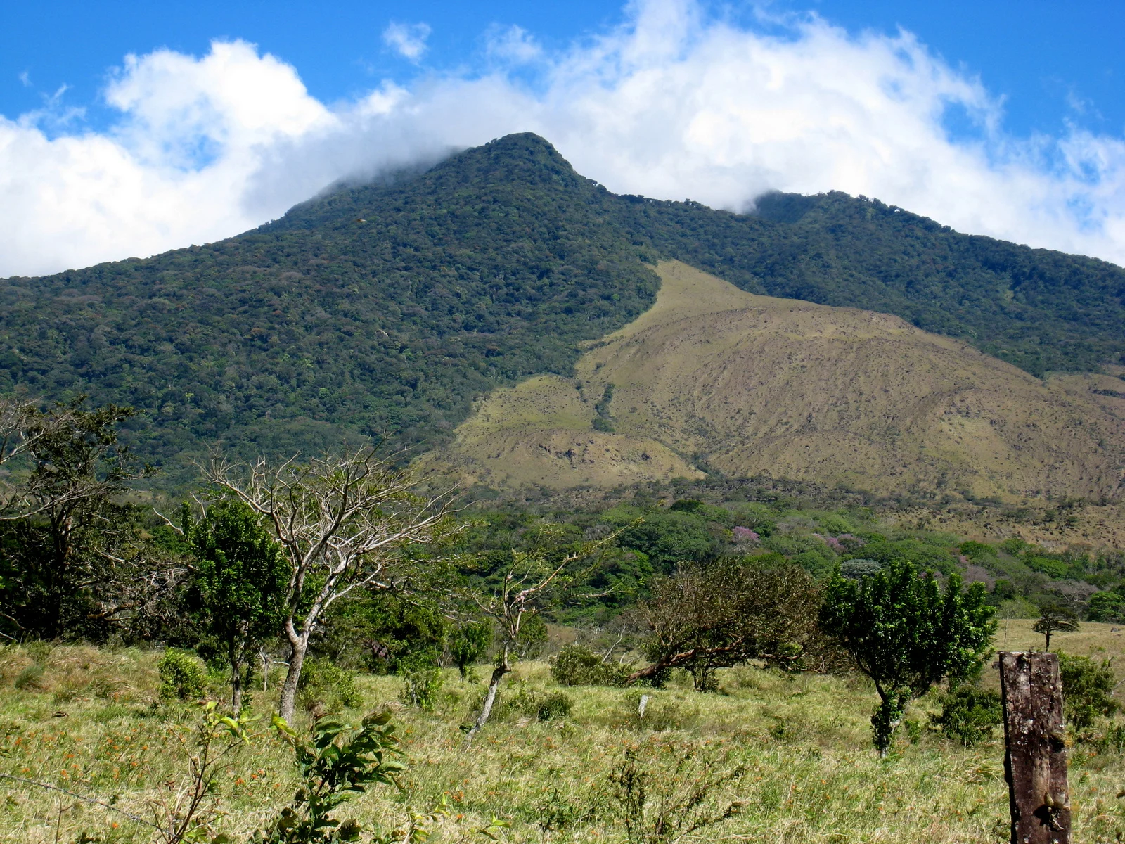
Miravalles is not visited like Poás, Irazú or Tenorio. There is no single visitor centre with a marked public trail to the crater: the usual visitor experience takes place on private properties around the lower slopes, offering hornillas, mud, hot springs, walks or booked activities. Choose a specific experience first and plan the drive second; do not arrive expecting an improvised “volcano entrance”.
Official trails: how they differ
Lower-slope geothermal experience
Hornillas, fumaroles, mud and hot-spring visits are run by private businesses rather than one uniform SINAC circuit. Distance, difficulty, fee, guiding and bathing rules vary: request those details in writing before paying.
Private-property hiking
Some properties offer forest, viewpoints or waterfalls, but a commercial trail is not automatically a public summit route. Confirm total distance, elevation gain, surface, guiding, return deadline and insurance; never cross gates or farm roads without permission.
Miravalles–Jorge Manuel Dengo National Park
The protected area conserves a 2,028-metre massif, forests and watersheds, but visitors should not assume it follows the same public-use model as a park with conventional ticketing and trails. Ask the Arenal Tempisque Conservation Area which sectors are open before travelling.
Miravalles energy landscape
Geothermal development made these slopes an important chapter in Costa Rican electricity: Miravalles I has operated since 1994. ICE industrial facilities are not open-access attractions; respect signs, property boundaries and operational roads.
How to choose a route
For a first visit, a booked half-day geothermal experience explains the landscape without pretending to reach the summit. Hikers should choose a route that publishes genuine distance and difficulty. Families and visitors with limited mobility or sensitivity to heat and sulphur should ask the operator about accessibility, walkways, temperatures and steam exposure.
How much time to allow
Book at least one day ahead and obtain the exact location: “Miravalles” can describe different sites around Guayabo, La Fortuna de Bagaces and neighbouring communities. A hot-spring visit may take half a day; hiking plus hot springs needs a full day. Start early from Liberia or La Fortuna and avoid pairing a strenuous walk with a long drive after dark.
Visibility, rain and terrain
Western Bagaces is generally drier, sunnier and hotter, while the northern and eastern slopes receive more moisture. Clouds may hide the summit even when a lower-slope tour continues, and rainy-season roads and trails can become muddy. Carry water, sun protection, a light rain layer and closed shoes, and check road access after heavy rain.
Mobility and real accessibility
There is no single answer because facilities differ. Some hot-spring experiences are short, while others include stairs, bridges, mud or slopes. Ask specifically about parking, toilets, surface, handrails and distance from reception; “family tour” does not guarantee universal accessibility.
Common mistakes on this visit
- Searching for “Miravalles Volcano” on a map and driving onto a rural road without selecting an authorised entrance or activity.
- Treating a private attraction, the national park and the ICE geothermal field as one public site.
- Accepting a supposed summit route without verifying the landowner, guide, distance, elevation, permissions and weather.
- Touching water, mud or steam outside designated areas; hydrothermal features can cause severe burns.
- Scheduling Llanos de Cortés, hornillas, hot springs and a long hike in one day without accounting for driving and opening hours.
A realistic day around Miravalles
- Before travelling: select an identifiable property or tour, reserve, and confirm location, price, duration, difficulty, equipment and rain policy.
- Morning: drive to Guayabo or the stated meeting point with enough fuel; complete the booked hike or geothermal interpretation first.
- Midday: rehydrate, change wet clothing if needed and eat in the community or where the operator confirms food service.
- Afternoon: use the hot springs or take a short activity within the same property, avoiding industrial facilities and unauthorised routes.
- Return: leave rural roads in daylight and save Llanos de Cortés or another distant attraction for a separate day if time is tight.
How it formed and works
Costa Rica’s National Seismological Network describes Miravalles as a complex stratovolcano made of overlapping edifices and smaller cones. The massif evolved through successive caldera collapses over roughly one million years, producing abundant lava, pyroclastic layers, pumice deposits and ancient volcanic landslides.
Landscape and ecosystems
Pacific and Caribbean influences create strong contrasts. The western slope descends toward the drier Bagaces landscape, while the north and east receive more moisture. The protected area conserves forest, springs and watersheds and forms an ecological connection within the Guanacaste Range.
Eruptive and human history
No recent historical magmatic eruption is recorded. The RSN documents a small steam-driven explosion in the hornillas field in 1946 and continuing secondary activity. Miravalles also became central to Costa Rican energy history when the country’s first commercial geothermal plant began operating there in 1994.
What you will find
- Views of the massif from Bagaces, Guayabo and La Fortuna de Bagaces.
- Hydrothermal features such as fumaroles, mud pools and hot water at authorized sites.
- The relationship between conservation, forest restoration and Costa Rican geothermal power.
Plan your visit
- Confirm with the Arenal Tempisque Conservation Area which public sectors, trails or park services are operating.
- Distinguish Miravalles Jorge Manuel Dengo National Park from private hot-spring businesses, tours and geothermal-field property.
- Use your own transport or a verified tour; attractions are dispersed and rural-road conditions change with rain.
Access and logistics
The usual approach runs from Bagaces toward Guayabo and La Fortuna de Bagaces. The park, private hornillas, hot springs and ICE facilities have separate entrances and permissions. Do not enter restricted roads or geothermal infrastructure without authorization.
Safety and volcanic activity
Steam, mud pools and hot ground can cause severe burns. Stay on authorized trails and platforms. For mountain hiking, verify weather, guide, legal access and conditions with SINAC; do not attempt informal crater routes.
Hours, rates, trails and conditions can change without notice. Official park information and staff instructions always take precedence.What to explore nearby
- Guayabo and La Fortuna de Bagaces for rural access and services.
- Llanos de Cortés and Bagaces for a waterfall, local heritage and tropical dry-forest scenery.
- Privately operated hot springs and hornillas tours, checking admission, safety and exact location before booking.
Specific sources and editorial review
Geological, protected-area and energy information reviewed 2 August 2026. Because there is no single public visitor circuit, confirm directly with SINAC and the chosen property before driving to Miravalles.