
Planning data
Practical visit facts
- Route or distance
- Misterios del Tenorio: 3 km to Teñidero and 6 km after returning along the same route.
- Suggested time
- About 3 hours, plus stops and possible rain delays.
- Admission and booking
- Official online ticket; published entry 8:00–14:00 and stay until 16:00.
- Available facilities
- Drinking water and toilets; paid private parking outside.
Distances, hours, access and facilities may change because of weather, maintenance or operating decisions. Always confirm with the official source before leaving.
Content reviewed on July 28, 2026Practical decision
Is it right for your trip?
The official visit does not climb Tenorio’s summit: it follows Río Celeste. The linear Misterios del Tenorio trail runs 3 km to Teñidero and 6 km after returning along the same route. Allow roughly three hours plus stops, and choose between the waterfall only or continuing to the viewpoint, Laguna Azul, borbollones and Teñidero according to weather, fitness and entry time.
Official trails: how they differ
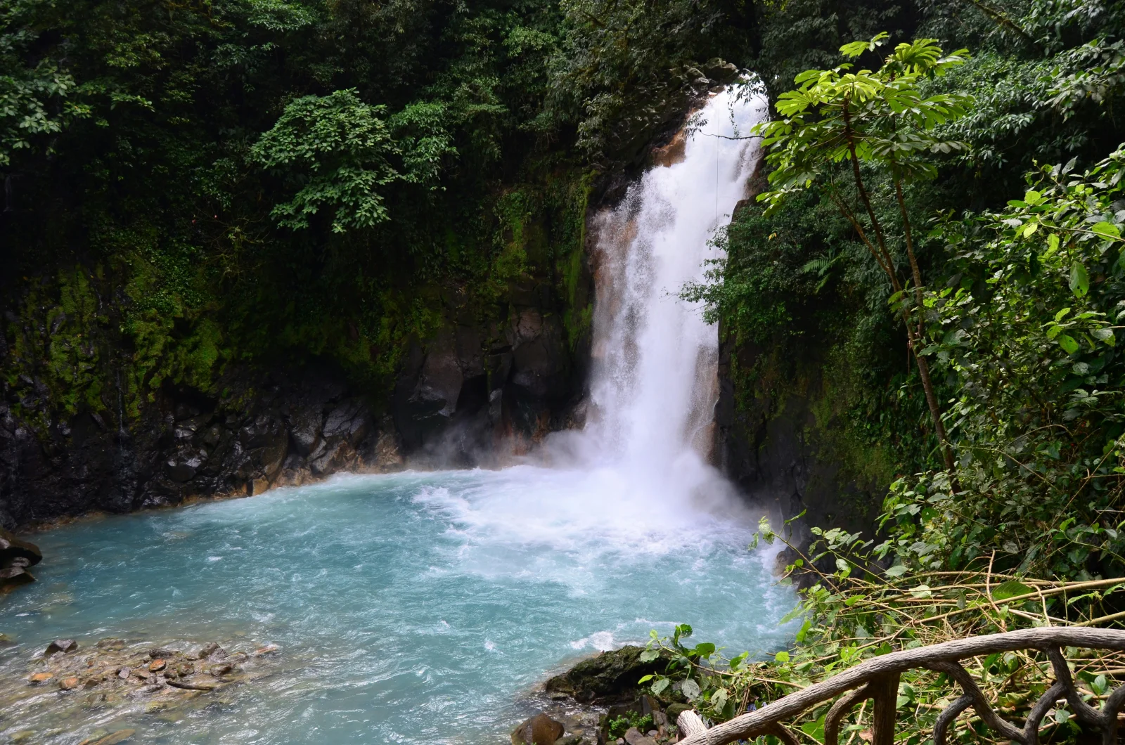
Río Celeste Waterfall
This is the first major attraction and requires descending and climbing a steep staircase. The viewpoint provides the waterfall view without entering the water; turning back here makes the walk considerably shorter than the full 6 km.
Volcano viewpoint
Beyond the waterfall, the trail continues through humid forest to an observation point. Clouds frequently hide the summit and a clear view is never guaranteed; value the forest rather than building the entire visit around one photograph.
Laguna Azul and borbollones
These are hydrothermal features. The borbollones release gas and heat: remain on the authorised route, do not touch the water and never treat them as bathing hot springs.
Teñidero · trail endpoint
Two initially clear streams meet here and the blue colour appears. UCR and UNA research rejected coloured metals as its cause: changing conditions enlarge suspended aluminosilicate particles, which then scatter blue light.
Full route · 6 km return
SINAC publishes 3 km each way and an approximate three-hour duration. This is a natural trail with roots, mud, humidity, bridges and elevation changes; rain, stops and congestion can increase walking time.
How to choose a route
Complete all 6 km if you have enough time, grippy footwear and tolerance for humidity and stairs. Choose the waterfall and return if travelling with children, starting late or reducing exertion. There is no transport from Teñidero: every visitor walks back. Rain and sediment can temporarily change the colour, so the classic photograph is not guaranteed.
How much time to allow
SINAC publishes entry from 8:00 to 14:00 and stay until 16:00, with tickets sold only through its official system. Arrive early for less time pressure and use an identifiable private car park outside; the park provides drinking water and toilets but no official parking. Recheck hours and admission before departure.
Visibility, rain and terrain
Bijagua and the park receive rain through much of the year. A clear morning can turn quickly into a downpour and the trail becomes slippery. Carry a rain layer, dry bag, water and closed footwear; avoid smooth sandals. Heavy rain may temporarily muddy Río Celeste or cause safety closures.
Mobility and real accessibility
The natural surface, slopes and long waterfall staircase are not universally accessible. Visitors unable to use the stairs will not obtain the main lower-trail view. Ask SINAC directly about current conditions and assistance, and do not rely on photographs that omit elevation and mud.
Common mistakes on this visit
- Buying from resellers or arriving without a reservation expecting tickets at the gate.
- Assuming the published 3 km is the return distance; the full route totals 6 km.
- Entering near 14:00 and attempting the entire route before the stay deadline.
- Entering the river, touching borbollones or leaving the trail; natural compounds and hot areas may be present.
- Confusing private waterfalls, hot springs or regional entrances with the official Tenorio Volcano National Park gate.
- Attributing the blue to copper, dye or visibly coloured liquids rather than the documented physical process.
A realistic Río Celeste visit
- Previous day: buy the official ticket, download proof and confirm driving route, rain, opening and the El Pilón entrance location.
- 7:30–8:00: reach the area, choose an identifiable private car park and organise rain gear, water and footwear before registration.
- First section: walk to the waterfall and reassess weather, stairs, available time and energy before committing to the remaining trail.
- Second section: continue past the viewpoint, Laguna Azul and borbollones to Teñidero without touching water or leaving the route.
- Return and afternoon: walk back along the same trail, eat in Bijagua and leave private hot springs or Caño Negro for a separately booked block.
How it formed and works
Costa Rica’s National Seismological Network classifies Tenorio as a polygenetic stratovolcano formed by several eruptive centres. The massif has three main cones aligned north-northwest, multiple craters and smaller structures; its products include lava flows, pyroclastic rocks, andesite, basaltic andesite and basalt.
Landscape and ecosystems
Caribbean moisture sustains very humid and rain forest across much of the park. The protected area safeguards headwaters and an important elevation transition rich in ferns, palms and epiphytes. Río Celeste’s colour becomes visible where waters with different characteristics mix and suspended particles scatter light.
Eruptive and human history
Tenorio has no recorded historical eruptions and the RSN describes it as dormant, although fumaroles and hot springs remain. The national park was created in 1995 and, together with the protective zone, conserves more than 18,000 hectares within the Water and Peace Biosphere Reserve.
What you will find
- Río Celeste Waterfall, an approximately 20-metre cascade surrounded by rainforest.
- The Teñidero, where the process producing the river’s blue appearance becomes visible.
- A viewpoint toward three cones of the massif, Blue Lagoon and volcanic bubbling vents.
Plan your visit
- Purchase admission in advance through SINAC’s official reservation system; tickets are not sold at the entrance.
- The linear Misterios del Tenorio trail totals approximately 6 km round trip and normally takes about 3 hours.
- Enter between 8:00 a.m. and 2:00 p.m.; SINAC allows visitors to remain until 4:00 p.m. and may restrict access because of capacity or trail conditions.
Access and logistics
The main visitor entrance is near El Pilón, approximately 9 km east of Bijagua. Approach from Route 6 on the road toward Río Celeste. Check the final road conditions during the rainy season and do not confuse the national-park entrance with private waterfalls, hot springs or properties nearby.
Safety and volcanic activity
Swimming in the river, leaving the trail, pets, drones and single-use plastics are prohibited inside the park. The bubbling vents release hot volcanic gases, so observe them only from the authorized trail. Rain can make the path and waterfall steps slippery.
Hours, rates, trails and conditions can change without notice. Official park information and staff instructions always take precedence.What to explore nearby
- Bijagua as the main base for lodging, meals and park access.
- Caño Negro and Guatuso for wetlands, Maleku culture and Northern Zone nature.
- Lake Cote, Upala and rural routes toward Miravalles and Arenal for multi-day itineraries.
Specific sources and editorial review
Operational information reviewed 2 August 2026. Hours, capacity, rain closures and trail conditions may change; SINAC’s official page and staff instructions take priority.