
Planning data
Practical visit facts
- Route or distance
- Barva Lagoon is about 3 km return, Cacho de Venado 1.9 km and Copey 5 km. The bus stops about 8 km before the entrance.
- Suggested time
- 4–7 hours depending on access and combination; longer by public transport.
- Admission and booking
- Confirm official purchase, road, parking and trails with SINAC; the brochure preferably recommends four-wheel drive.
- Available facilities
- Water, toilets, café, tables, parking and regulated camping; carry warm layers, rain protection and food.
Distances, hours, access and facilities may change because of weather, maintenance or operating decisions. Always confirm with the official source before leaving.
Content reviewed on July 28, 2026Practical decision
Is it right for your trip?
Choose Barva for a wet cloud-forest hike to a crater lagoon. Do not choose it for an open volcanic viewpoint, easy public-transport access or a quick stop like Irazú. The final approach can be as decisive as the trail itself.
Official trails: how they differ
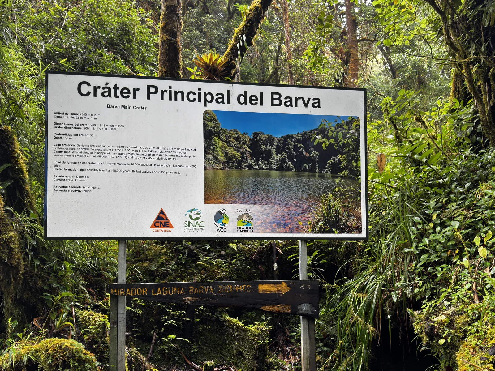
Barva Lagoon · approximately 3 km return
The essential first-visit route. An ICT technical document estimates about two hours, but mud, birdwatching and pauses can make it longer. It includes viewpoints over the crater lagoon.
Cacho de Venado · approximately 1.9 km return
A forest circuit suited to a shorter walk and birdwatching. A historical official reference estimates about 1 hour 40 minutes; surface conditions matter more than the isolated number.
Copey Lagoon · approximately 5 km return
An option for stronger walkers with sufficient time. Official material estimates about three hours; do not automatically add it after Barva Lagoon without checking connections, time and trail condition.
Vara Blanca viewpoint · approximate 900 m spur
An extension towards a panorama that depends on cloud. Confirm how the published length relates to the available spur and how it changes the day’s total distance.
How to choose a route
For a first visit, prioritise Barva Lagoon and add Cacho de Venado only after an early arrival and in suitable conditions. Copey deserves better preparation. Travellers relying on the bus must understand that SINAC reports an additional 8 km walk from the final stop to the entrance before any internal trail begins.
How much time to allow
Allow 4–7 hours from the beginning of the rural approach until your return, depending on vehicle and route. SINAC lists daily hours from 08:00 to 15:30, and the official brochure gives 15:00 as the last trail-entry time. That does not make a long route sensible late in the day; arrive in the morning for Barva Lagoon or Copey.
Visibility, rain and terrain
Expect cold, rain, fog and mud even in the relatively drier season. Carry rain protection, a light insulating layer, closed footwear with grip and dry clothing protected inside your pack. Cloud may remove the viewpoint panorama but not the forest experience. Shorten or stop the hike during thunderstorms, strong wind or whenever staff advise it.
Mobility and real accessibility
Trails use natural surfaces with mud, roots, gradients and persistent moisture and should not be presented as universally accessible. Public transport adds substantial walking, and the final road can be rough. The official brochure preferably recommends a four-wheel-drive vehicle. Contact the park before travelling if anyone has reduced mobility, a recent injury or needs assistance.
Common mistakes on this visit
- Confusing the Barva Volcano Sector with Quebrada González because both belong to Braulio Carrillo National Park.
- Arriving by bus without adding SINAC’s reported 8 km walk to the entrance.
- Attempting the final road without checking rain, road condition, parking and the vehicle’s capability.
- Reading “1.5 km to Barva Lagoon” as a complete total without accounting for the corresponding return.
- Starting Copey close to last admission simply because the park is still open.
- Walking without water, food, rain protection or waterproof storage for electronics.
- Expecting an exposed mineral crater: the distinctive attraction is an old crater covered by forest and water.
- Camping without booking, paying the corresponding fee or using the authorised days and area.
A sensible day in the Barva Volcano Sector
- Before departure: confirm admission, road condition, open trails, rainfall and parking arrangements directly with SINAC.
- 07:00–08:00: complete the rural approach with margin; public-transport planning must begin much earlier because of the additional walk.
- 08:00–11:00: make Barva Lagoon the principal objective and adapt pace to mud and visibility.
- 11:00–13:00: eat in the authorised area and add only a short trail if staff, weather and energy allow.
- After 13:00: begin the return; keep Barva or Heredia as a flexible extension and avoid driving the rural approach for the first time after dark.
How it formed and works
Barva is not an isolated cone but, according to the National Seismological Network, Costa Rica’s largest volcanic edifice by area and volume. It is a complex shield covering approximately 1,100 km², with about ten cones and craters developed within older collapse structures. Thick lava flows and explosive deposits lie beneath deep soils and forest. Barva and Copey lagoons occupy crater depressions: geology here is interpreted under vegetation rather than across exposed rock walls.
Landscape and ecosystems
The Barva Volcano Sector reaches about 2,906 m and protects cloud forest, oak woodland, moss, ferns and epiphytes fed by Caribbean moisture. The park reports temperatures that can fall to roughly 3 °C in the highlands. Rain, fog and mud are normal parts of the experience. Barva Lagoon can appear dark and still, while smaller Copey may shrink considerably during the dry season.
Eruptive and human history
Barva has no documented historical eruptive phase comparable to Poás, Irazú or Arenal, yet it preserves numerous eruptive centres and evidence of a more intense past. The absence of recent spectacle allowed forest to cover craters and volcanic material. The creation and later expansion of Braulio Carrillo National Park protected this massif, its headwaters and the ecological connection between the Central Valley and Caribbean slope.
What you will find
- Trail to Barva Lagoon within cloud forest.
- Copey Lagoon, Cacho de Venado and viewpoints when their routes are open.
- Highland birds, oak forest, epiphytes and a well-preserved forest transition.
Plan your visit
- Reserve online and confirm which trails are open.
- Carry rain protection, warm layers, water and shoes with traction; mud is common.
- Leave ample time for the round trip. This is not a quick roadside stop.
Access and logistics
Approach through Barva, San José de la Montaña, Paso Llano and Sacramento. SINAC recommends four-wheel drive for the final section. Public transport may leave hikers roughly 8 km from the entrance gate.
Safety and volcanic activity
Fog, rain, cold and mud can reduce visibility and extend hiking time. Stay on marked trails. Camping follows separate days, payment and coordination rules.
Hours, rates, trails and conditions can change without notice. Official park information and staff instructions always take precedence.What to explore nearby
- Barva and Heredia for urban heritage, churches, markets and food after a shorter hike.
- San José de la Montaña and Sacramento are approach communities, not substitutes for the official entrance or guaranteed parking.
- Quebrada González is in the same national park but lies on Route 32 and belongs on another day; it shares neither entrance nor trail network with Barva.
Specific sources and editorial review
Operational information reviewed 31 July 2026. Road, trails, ticket purchase and camping service can change; confirm them with SINAC before travelling.