
Planning data
Practical visit facts
- Route or distance
- Steep descent on a long staircase; every step down must be climbed back up.
- Suggested time
- 2–3 hours, depending on fitness.
- Admission and booking
- Private attraction with its own admission.
- Available facilities
- Reception and basic services; confirm trail status after rain.
Distances, hours, access and facilities may change because of weather, maintenance or operating decisions. Always confirm with the official source before leaving.
Content reviewed on July 28, 2026What you will find
- Deep drop into an ancient volcanic crater.
- Cloud forest, gardens and viewpoints in a private reserve.
- Demanding descent with changing perspectives of the fall.
How to plan the visit
- Book through the official website and check opening days.
- Avoid pairing it with another demanding hike unless fit.
- Carry a light layer and rainwear; weather changes quickly.
Access and transport
Mountain roads connect Bajos del Toro with Sarchí, Zarcero and Río Cuarto. Fog, rain and curves increase journey times.
Trail and conditions
The route has substantial elevation and many steps. Terrain is often damp; the visit focuses on trails and viewpoints rather than swimming.
Water and safety
Do not leave railings or trails for photographs. Visitors with limited mobility, heart or knee conditions should assess the descent carefully.
On-site signs, staff and official closures always take precedence over this guide.Responsible visit
Respect the private reserve, minimize noise and remove no plants, stones or wildlife from the cloud forest.
How to understand this waterfall
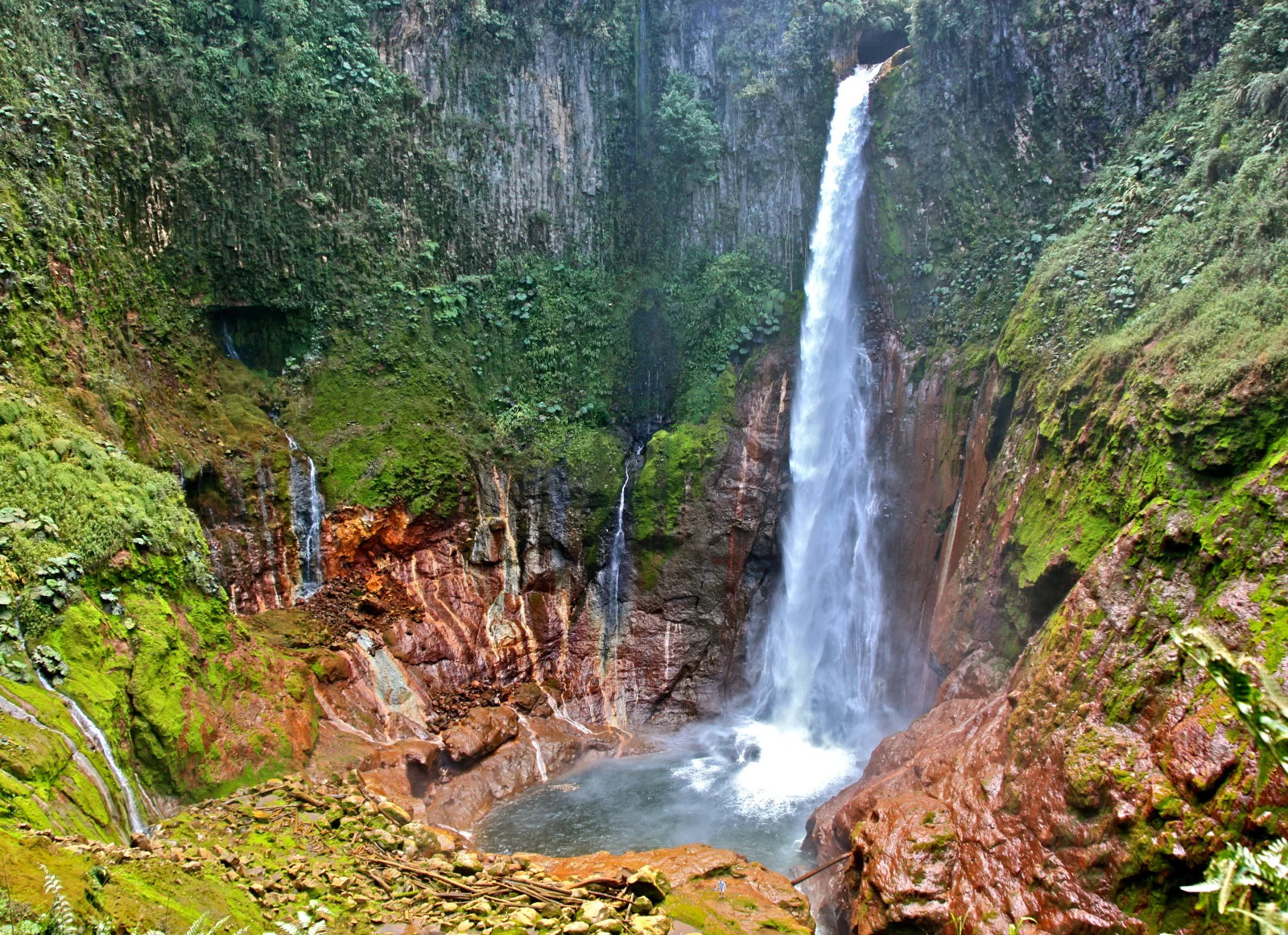
Water drops into a deep volcanic formation. Crater geometry, rock layers and cloud forest create a vertical experience centred on observation rather than a pool.
The private reserve also protects gardens and forest where persistent moisture supports ferns, moss and birds. Four upper viewpoints explain the setting before the descent.
Practical plan
- Recommended time
- 2 to 3 hours
- Best base
- Bajos del Toro, Sarchí or Zarcero
- Actual effort
- Moderate to high: major elevation and many stairs
- Swimming
- Not permitted
Step-by-step route
Gardens and upper viewpoints
Four observation pointsCompare angles, rock and vegetation. In heavy mist, wait for visibility changes before descending.
Crater descent
Many stairs · persistent moistureUse rails and conserve energy. Reaching the lowest point is optional if knees, vertigo or weather do not cooperate.
Return and bird observation
Demanding climbThe exit contains the greatest effort. Recover at the top and avoid driving immediately when exhausted.
What to combine nearby
Bajos del Toro
The area contains several properties with different waterfalls. Confirm the exact name and do not follow signs to another entrance.
Blue Falls
It may be booked separately or as a combination under current operations; it adds walking and a different water experience.
Questions before leaving
Is 4×4 required?
The operator lists three paved approaches via Sarchí, Zarcero or Río Cuarto and says 4×4 is unnecessary for this entrance.
Can I swim?
No. The official site prohibits swimming and pets. This is a trail-and-viewpoint visit.
Is it open Sundays?
The official page consulted lists Monday–Saturday, 7:00–17:00, with Sunday closed. Reconfirm before travel.
Editorial review: August 3, 2026. Opening, flow, access and swimming areas may change; reconfirm with the responsible operator.