
Planning data
Practical visit facts
- Route or distance
- Inside the park, Playa Blanca, Perezoso and Los Cativos offer 1.7–2.8 km sections; the full route depends on access.
- Suggested time
- 4–6 hours for trail and beach.
- Admission and booking
- Cahuita National Park rules depend on the entrance sector.
- Available facilities
- Services at entrances and in Cahuita; do not expect supplies throughout the trail.
Distances, hours, access and facilities may change because of weather, maintenance or operating decisions. Always confirm with the official source before leaving.
Content reviewed on July 28, 2026What you will find
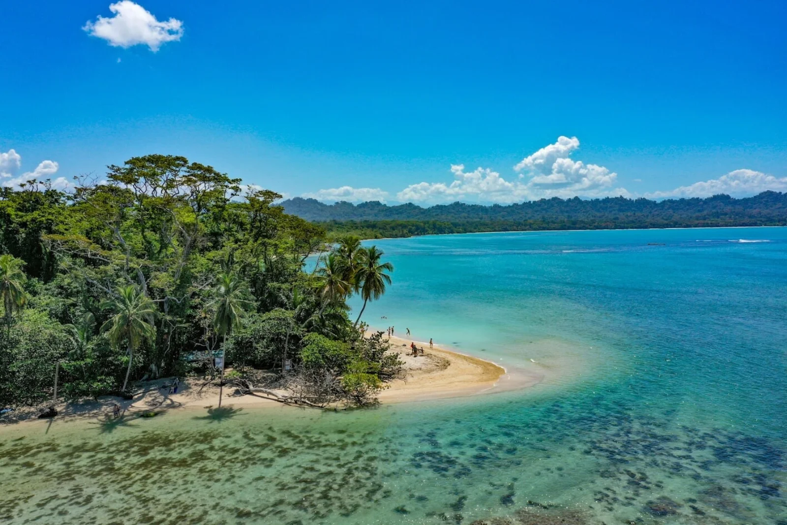
- Pale beaches, coastal forest and a trail between sectors.
- Sloths, monkeys, raccoons and iguanas viewed from a distance.
- Reef visits only under authorized rules and conditions.
How to plan the visit
- Choose Playa Blanca or Puerto Vargas entrance and check sector-specific hours and fees.
- For snorkelling, hire an authorized guide and confirm visibility and sea state.
- Protect food and belongings without feeding or confronting animals.
Access and transport
Playa Blanca is beside Cahuita village; Puerto Vargas is reached from Route 36. Plan the return to your starting point if walking the complete trail.
Services and infrastructure
Cahuita village has food, lodging and buses. Park facilities depend on sector and opening hours.
Season and climate
Rain is possible year-round. Relatively drier periods often occur in February–March and September–October.
Sea, tides and safety
Do not swim during strong surf, storms or warnings. Respect reef closures and keep distance from raccoons, monkeys and snakes.
Sea conditions can change rapidly. Local information, lifeguards, park rangers and official closures always take precedence.Responsible visit
Never touch coral or marine life. Follow ranger instructions and support clearly identified community guides and businesses.
Is this beach right for you?
Cahuita integrates park, community and coast. Playa Blanca starts beside town with a voluntary contribution; Puerto Vargas has a fee and parking. Choose access by transport and route.
How to understand this destination
Cahuita protects 1,102 terrestrial and 23,290 marine hectares. The route combines forest, coast and one of Costa Rica’s most developed Caribbean reefs, so the beach cannot be separated from its ecological context.
The entrances work differently. Playa Blanca integrates with town and receives a voluntary cash contribution; Puerto Vargas has a fee, card payment and parking. Both are currently listed 8:00–16:00.
Practical stay plan
- Suggested time
- Allow 2–4 nights for park, community, beach and another southern Caribbean stop.
- Where to base yourself
- Cahuita village places Playa Blanca within walking distance; Puerto Vargas is reached from Route 36 and has official parking.
- Getting around
- Bus and walking work well from town. When moving between sectors, plan the return rather than assuming the vehicle will be nearby.
- A workable pace
- Enter early, walk before peak heat, choose beach according to the sea and reserve late afternoon for the community.
Sectors and important differences
Playa Blanca
SINAC lists 8:00–16:00 and voluntary cash contribution. A walkway reaches the beach.
Puerto Vargas
Route 36 access with fee, card and parking; also open 8:00–16:00.
Reef
Snorkel only in authorised zones and conditions with a guide. Never stand on coral.
What to combine nearby
Cahuita village
Eat and book clearly identified local services. Community participation forms part of the park model.
Puerto Vargas
A separate entrance and logistical choice. If walking between sectors, arrange return transport before starting.
Puerto Viejo and Punta Uva
Better as another day; combining the full park, snorkelling and several corridor beaches usually creates a rushed visit.
Mistakes to avoid
- Finishing at the other sector without transport.
- Independent snorkelling or entering rough water.
- Showing food to monkeys and raccoons.
A realistic day
- Morning: chosen entrance and trail.
- Midday: beach and protected food.
- Afternoon: planned return and local food.
Frequently asked questions
How much is admission?
Playa Blanca requests a voluntary cash contribution; Puerto Vargas has differentiated fees. Confirm current amounts with SINAC.
Can visitors snorkel independently?
It should not be improvised. Reef visits use authorised zones and conditions with an identifiable local guide and suitable sea.
Can the full trail be crossed?
It depends on open routes, fitness, heat and time. You must also solve the return to the entrance.
Official sources and further reading
Editorial verification: Reviewed 2 August 2026. Both sectors are listed 8:00–16:00; verify sea and activities.