
Your data remains only in this browser.

My local profile

0Favorites0Visited0Want to visit0My itineraries

Preferences

Topics you are interested in

Recommended for you

Destinations related to your interests that you have not marked yet.

♡ Favorites

    ✓ Visited

      + Want to visit

          Take your profile to another device

          Download a JSON copy or import one created by Costa Rica Hub.

          This profile does not create an account, is not sent to Costa Rica Hub and may disappear if you clear browser data.

          Costa Rica Hub

          Search Costa Rica Hub

          Enter at least 2 characters to search guides, destinations, tools and articles.

            Santa Rosa Sector, Santa Rosa National Park, Guanacaste

            Santa Rosa Historic Casona Museum

            A visit connects two inseparable histories: the defence of sovereignty during the National Campaign and the transformation of a former cattle estate into a protected area. The Casona, corrals and monuments place the battle in a real landscape rather than an abstract narrative.

            National Campaign and hacienda cultureNorthern Guanacaste1856 battle · sovereignty · ranching landscape
            Add to itinerary
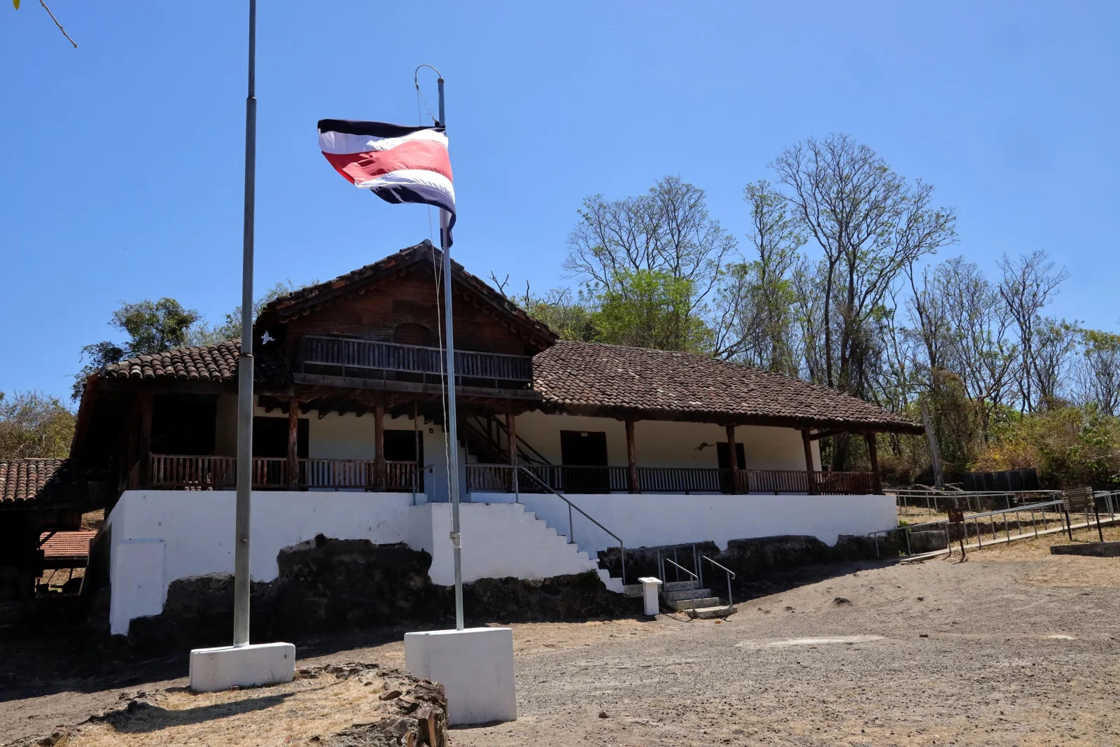
            Historic Santa Rosa Casona and corrals in the dry forest of Guanacaste

            History and context

            On 20 March 1856, Costa Rican forces defeated a filibuster contingent associated with William Walker at Santa Rosa. The brief but decisive engagement was the first major victory of the National Campaign. The estate later accumulated ranching and political memories before becoming part of the national park.

            Why this place matters

            Santa Rosa is a symbol of sovereignty and a place to examine how national memory is constructed. Contemporary interpretation can connect the battle with soldiers and communities, the regional history of Guanacaste and the conservation of dry forest.

            What to notice during your visit

            • The reconstructed Casona serving as museum and focal point of the historic sector.
            • Stone and timber corrals associated with the former hacienda landscape.
            • Monuments and open areas that help locate the 1856 engagement.
            • The immediate transition from historic heritage to dry-forest ecosystems.

            How to plan your visit

            1. Check SINAC for the historic sector’s status, admission and road conditions.
            2. Carry water, sun protection and a hat because heat can be intense throughout much of the year.
            3. Read the exhibition before walking through the corrals to understand the battle sequence.
            4. If combining history with nature trails, plan a longer day and check all distances.

            Access and location

            The Santa Rosa Sector lies inside the national park and is reached from the Inter-American Highway North along an internal road. Confirm current entry and road conditions with SINAC.

            Conservation and responsible visits

            Do not touch display objects or climb walls and corrals. Natural-protection rules also apply: never feed wildlife, remove materials or leave any waste.

            Keys to interpreting the site

            How do battle, ranch and conservation meet at one site?

            01

            National Campaign

            The 20 March 1856 battle belongs within the conflict against filibuster forces rather than standing as an isolated episode.

            02

            Ranch landscape

            Corrals, savanna and routes recall Santa Rosa as a productive, cattle and regional circulation space.

            03

            Reconstructed memory

            Today’s Casona includes restoration after the 2001 fire; heritage conservation can involve documented reconstruction.

            Suggested visit sequence

            1. 01

              Begin in the museum to locate actors, dates and the engagement.

            2. 02

              Step outside and connect the building with corrals, dry forest and routes.

            3. 03

              End by asking how national-park creation changed the meaning of a former ranch.

            How to combine this visit

            Give the rest of the day to the historic sector and nearby trails; Playa Naranjo requires separate logistics and 4×4.

            Location

            Location on the map

            Use the map as a reference to identify the area and plan your journey.

            Open in Google Maps ↗

            Google Maps is an external service. The map loads only after you choose to show it, and Google may receive technical connection data.

            Important: The marker identifies the destination or its general area; it may not be the entrance, parking area or trailhead. Confirm official access before departure.

            Sources and editorial review

            Sources and editorial review

            This guide summarizes institutional information and reference sources. Hours, fees and access may change.

            Last editorial review: July 29, 2026

            ← Back to History and heritage