
Your data remains only in this browser.

My local profile

0Favorites0Visited0Want to visit0My itineraries

Preferences

Topics you are interested in

Recommended for you

Destinations related to your interests that you have not marked yet.

♡ Favorites

    ✓ Visited

      + Want to visit

          Take your profile to another device

          Download a JSON copy or import one created by Costa Rica Hub.

          This profile does not create an account, is not sent to Costa Rica Hub and may disappear if you clear browser data.

          Costa Rica Hub

          Search Costa Rica Hub

          Enter at least 2 characters to search guides, destinations, tools and articles.

            Downtown Cartago, Cartago

            Santiago Apóstol Parish Ruins

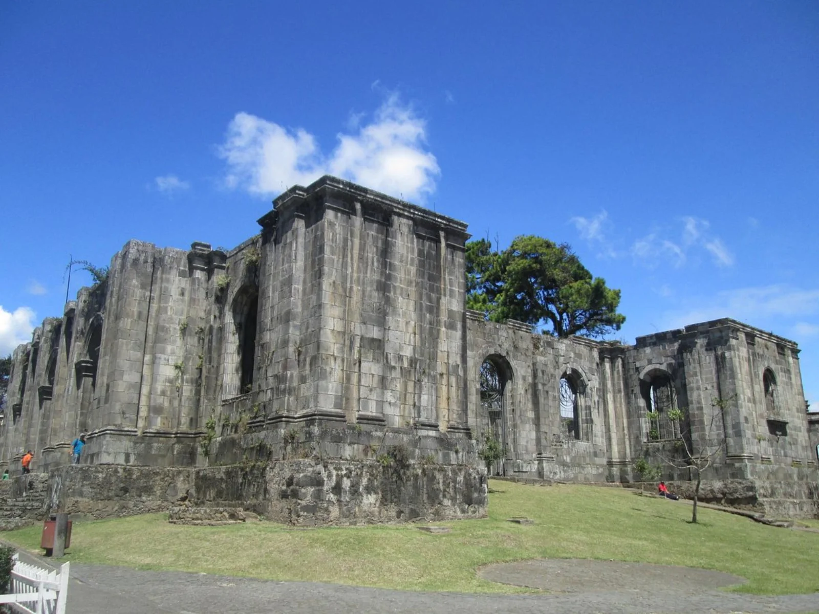
            The landmark known as the Cartago Ruins is not simply the remnant of one destroyed church, but the unfinished work of a new parish following a long sequence of buildings and earthquakes. Its stone walls make the city’s seismic history visible in the middle of a busy urban centre.

            Unfinished architecture and seismic memoryEl Guarco ValleyUrban history · earthquakes · heritage garden
            Add to itinerary
            Stone walls and inner garden of the Santiago Apóstol Parish Ruins in Cartago

            History and context

            The first parish dates to approximately 1575–1580 and was followed by several reconstructions. The visible building belongs to a project intended as the fourth church. It was still under construction when the 1910 Santa Mónica earthquake damaged Cartago and brought the work to a permanent halt.

            Why this place matters

            The complex represents both the persistence of Cartago’s community and the limits geology placed on its architecture. It also shows how an unsuccessful project can gain a new meaning: the intended church became a garden, meeting place and symbol of the city.

            What to notice during your visit

            • Large stone walls and Romanesque Revival openings that never supported a completed roof.
            • The contrast between a monumental religious structure and the public garden inside.
            • The sequence of parish buildings affected by earthquakes since the colonial period.
            • A walkable location near other landmarks in Cartago’s historic centre.

            How to plan your visit

            1. Walk around the perimeter first to understand its scale before entering the garden when open.
            2. Combine the stop with the Basilica, Municipal Museum and other central landmarks.
            3. Check for closures caused by events, maintenance or structural precautions.
            4. Never climb walls or enter restricted areas.

            Access and location

            The ruins stand beside Cartago’s main square and are easy to reach on foot from much of the centre. Urban parking is limited, while train and bus services make a car unnecessary.

            Conservation and responsible visits

            Do not climb the masonry or lean bicycles and heavy objects against it. Follow precautionary closures and help keep clean a place that serves as both monument and urban garden.

            Keys to interpreting the site

            How did an unfinished church become an urban symbol?

            01

            Layers of rebuilding

            The visible project belongs to a succession of parishes shaped by earthquakes, design changes and community persistence.

            02

            Interrupted architecture

            Walls, arches and the missing roof reveal a halted project—not simply a completed church destroyed at once.

            03

            New public use

            The garden turned a failed construction into civic space. That transformation is part of its heritage value.

            Suggested visit sequence

            1. 01

              Walk the perimeter first to compare façades and the urban grid.

            2. 02

              Enter the garden when open and read the intended scale of the nave.

            3. 03

              Continue to the main square, cathedral and nearby landmarks to place the ruins within Cartago.

            How to combine this visit

            Include it in a central walking route with the basilica, Municipal Museum and buildings tied to the former capital.

            Location

            Location on the map

            Use the map as a reference to identify the area and plan your journey.

            Open in Google Maps ↗

            Google Maps is an external service. The map loads only after you choose to show it, and Google may receive technical connection data.

            Important: The marker identifies the destination or its general area; it may not be the entrance, parking area or trailhead. Confirm official access before departure.

            Sources and editorial review

            Sources and editorial review

            This guide summarizes institutional information and reference sources. Hours, fees and access may change.

            Last editorial review: July 29, 2026

            ← Back to History and heritage