
Route facts
- Distance
- About 5.5 km round trip on a commonly recorded variant
- Estimated time
- 2–4 hr, depending on access, weather and pace
- Elevation
- Low ridges with short, steep climbs
- Difficulty
- Moderate; exposed to wind and sun
There is no single public measurement for Cerro Pelado because the trailhead depends on the authorized property or operator. A commonly recorded variant is about 5.5 km round trip, but the actual distance can change. Confirm the entrance, parking, permitted route and closing time in writing before departing.
What you will find
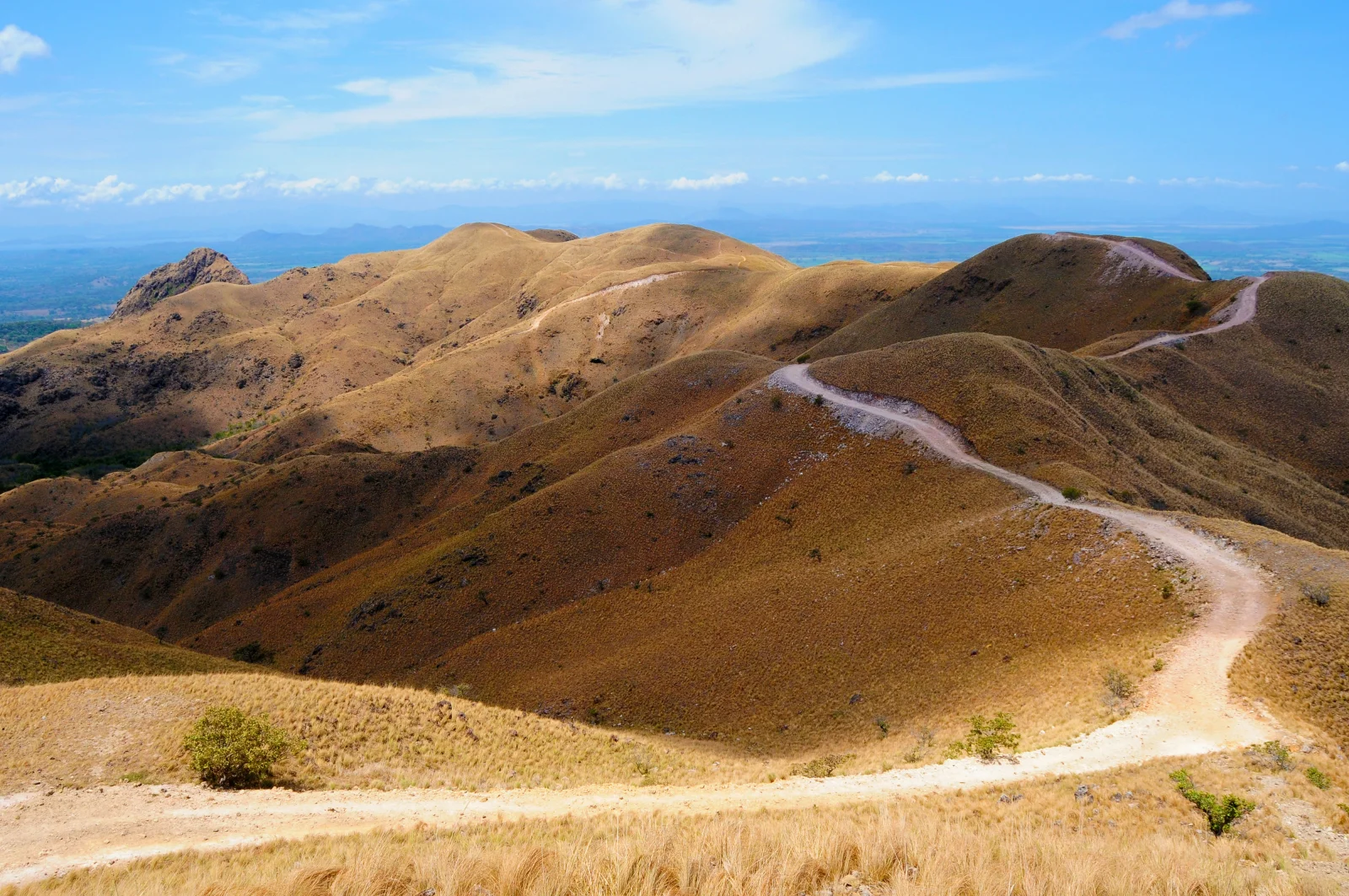
- Exposed ridges, sunrises and Guanacaste scenery.
- Short but steep sections where wind changes the perceived effort.
- Open views requiring more sun protection than a forest hike.
How to plan the visit
- Confirm current access; carry water, sun protection and a wind/rain layer.
- Request the exact parking point and route authorized by the property.
- Avoid peak heat and do not approach exposed edges for photographs.
Access and transport
Use only the reserved entrance and ignore app routes crossing farms.
Trail and conditions
Strong wind, heat, little shade and slippery slopes are common.
Mountain safety
Strong wind, heat, little shade and slippery slopes are common.
On-site signs, staff and official closures always take precedence over this guide.Responsible visit
Respect property, permits, trails and communities; leave no waste and do not publicize sensitive access without context.
How to understand this mountain
Cerro Pelado differs from forested mountains through grassy hills, narrow ridge passages and open Guanacaste panoramas. The lack of trees amplifies wind and radiation, so a visually short route can feel far harder at midday.
There is no single public trail that can simply be copied from an app. Trailheads cross private property; a commonly recorded variant is about 5.5 km round trip, but the valid route depends on the booked entrance that day.
Essential logistics
- Recommended format
- A half-day hike with confirmed private access
- Starting point
- Entrance and parking supplied by the property or operator
- Main exposure
- Sun, heat, crosswinds and unshaded ridges
- Guide and accompaniment
- Recommended when the authorized property and variant are unfamiliar
Route by stages
Registration and route briefing
Private property · variable rulesRequest the exact location, entry and exit times, parking and boundaries. A summit coordinate grants no permission to cross another farm.
Opening slopes
Short, steep climbsControl effort before the ridges. Dry ground may be loose, while rain turns clay slippery.
Ridges and return
Maximum wind and storm exposureNever walk edges for a photograph. If thunder develops or wind prevents stable movement, descend on the authorized route.
Decisions that shape the experience
Sunrise does not mean free access
Early visits still require permission, hours and operator safety rules.
Carry independent water
Assume no potable source on the ridges and carry enough for heat and delays.
Do not blindly follow digital tracks
Shared routes may belong to another property or have changed through erosion and management.
What to combine nearby
Cañas
Practical base for fuel, food and lodging before an early departure.
Bagaces and Miravalles
Geothermal scenery and forest work on another day; do not add long hikes or hot springs without considering fatigue and travel.
Questions before booking
What is the exact distance?
No one figure applies to every access. About 5.5 km describes a common variant; confirm the booked route.
Can I arrive without booking?
That is not advisable. The terrain spans private properties and access must be coordinated with an identifiable party.
Is it an easy family hike?
It depends on age, heat, wind, slope and property rules. Exposed ridges demand continuous supervision and a return margin.
Editorial review: August 3, 2026. Access, permits, capacity, trails and conditions may change; reconfirm with the responsible management or organization.