
Route facts
- Distance
- 14.5 km to Crestones Base + about 1.9 km to the formations
- Estimated time
- 6–9 hr to the base; 1–2 hr outing from the base
- Elevation
- Crestones Base: 3,393 m; high-mountain terrain
- Difficulty
- Extreme ascent; moderate–high from the base
Los Crestones is not a separate roadside hike: visitors must first complete the official 14.5 km ascent to Crestones Base. The park brochure places the formations roughly 1.9 km from the lodge. Extra time depends on acclimatization, rain and whether the outing is combined with Terbi, Sabana de los Leones or Valle de los Conejos.
What you will find
- Rock scenery, páramo and routes toward Terbi and Valle de los Conejos.
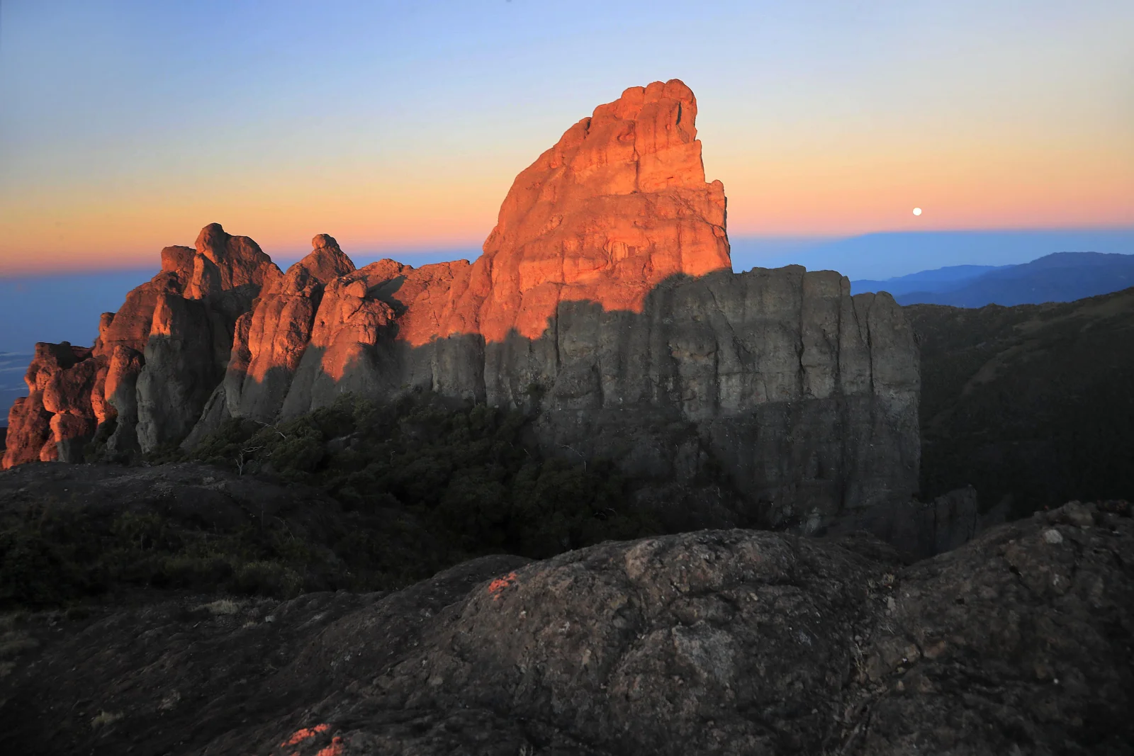
- Intrusive rock formations rising above the Talamanca landscape.
- A high-mountain panorama distinct from the Chirripó summit experience.
How to plan the visit
- Include them in an authorized itinerary and never climb outside designated routes.
- Leave Crestones Base with enough daylight and ask about trail conditions that morning.
- Do not combine several long circuits when fog, wind or fatigue reduces the safety margin.
Access and transport
Reached from Crestones Base after the official ascent.
Trail and conditions
Weather changes rapidly and wet rock is dangerous.
Mountain safety
Weather changes rapidly and wet rock is dangerous.
On-site signs, staff and official closures always take precedence over this guide.Responsible visit
Respect property, permits, trails and communities; leave no waste and do not publicize sensitive access without context.
How to understand this mountain
Los Crestones is a Costa Rican natural symbol but not an independent roadside hike. Visitors must first enter Chirripó National Park and complete the 14.5 km main trail to Crestones Base, or arrive through another expressly authorized approach.
The park brochure places the formations about 1.9 km from the base. That short number is deceptive: the walk occurs above 3,300 metres after a strenuous day, where wind, fog and wet rock quickly change effort.
Essential logistics
- Recommended format
- An internal outing from Crestones Base within a larger expedition
- Starting point
- Crestones Base, after completing an authorized approach
- Main exposure
- Wet rock, wind, fog and high-altitude radiation
- Guide and accompaniment
- Depends on access and booking conditions; always follow staff
Route by stages
Assessment at Crestones Base
Before adding another outingCheck fatigue, feet, hydration and weather. When the approach has taken longer than expected, move the visit rather than leaving without a margin.
Páramo approach
About 1.9 km from the baseStay on the signed line to protect slow-growing vegetation. Fog can hide junctions and remove visual reference to the base.
Formation sector
Viewing, not improvised climbingRock faces are not unrestricted viewpoints. Avoid climbing, edges and shortcuts; take photographs only from safe route positions.
Decisions that shape the experience
Do not stack objectives by obligation
Summit, Crestones, Ventisqueros and internal valleys do not responsibly fit every reservation.
Count the complete return
The outing finishes back at Crestones Base, with the San Gerardo descent still due on the relevant day.
Protect the páramo
Leaving the trail compacts soil and harms plants adapted to extreme conditions that recover slowly.
What to combine nearby
Cerro Terbi and Valle de los Conejos
SINAC lists a 6.1 km route that can form another outing, not an automatic Crestones extension.
Cerro Ventisqueros
Its 3.1 km trail from the base reaches 3,812 m and needs a separate weather assessment.
Questions before booking
Can I visit without booking Chirripó?
Not by the official route described. It lies inside the park and depends on authorized admission and logistics.
Is the total hike only 1.9 km?
That is the reference from Crestones Base. Reaching the base and returning are part of the larger effort.
Can the formation be climbed?
Never assume so. Remain on designated trails and viewpoints; climbing or off-route travel would require explicit authorization if allowed.
Editorial review: August 3, 2026. Access, permits, capacity, trails and conditions may change; reconfirm with the responsible management or organization.