
Planning data
Practical visit facts
- Route or distance
- Demanding hike on private land; itinerary depends on the booked route.
- Suggested time
- 4–6 hours, with extra margin after rain.
- Admission and booking
- Book through an authorised access or operator; do not improvise entrances.
- Available facilities
- Services are concentrated at the start; carry enough water and food.
Distances, hours, access and facilities may change because of weather, maintenance or operating decisions. Always confirm with the official source before leaving.
Content reviewed on July 28, 2026What you will find
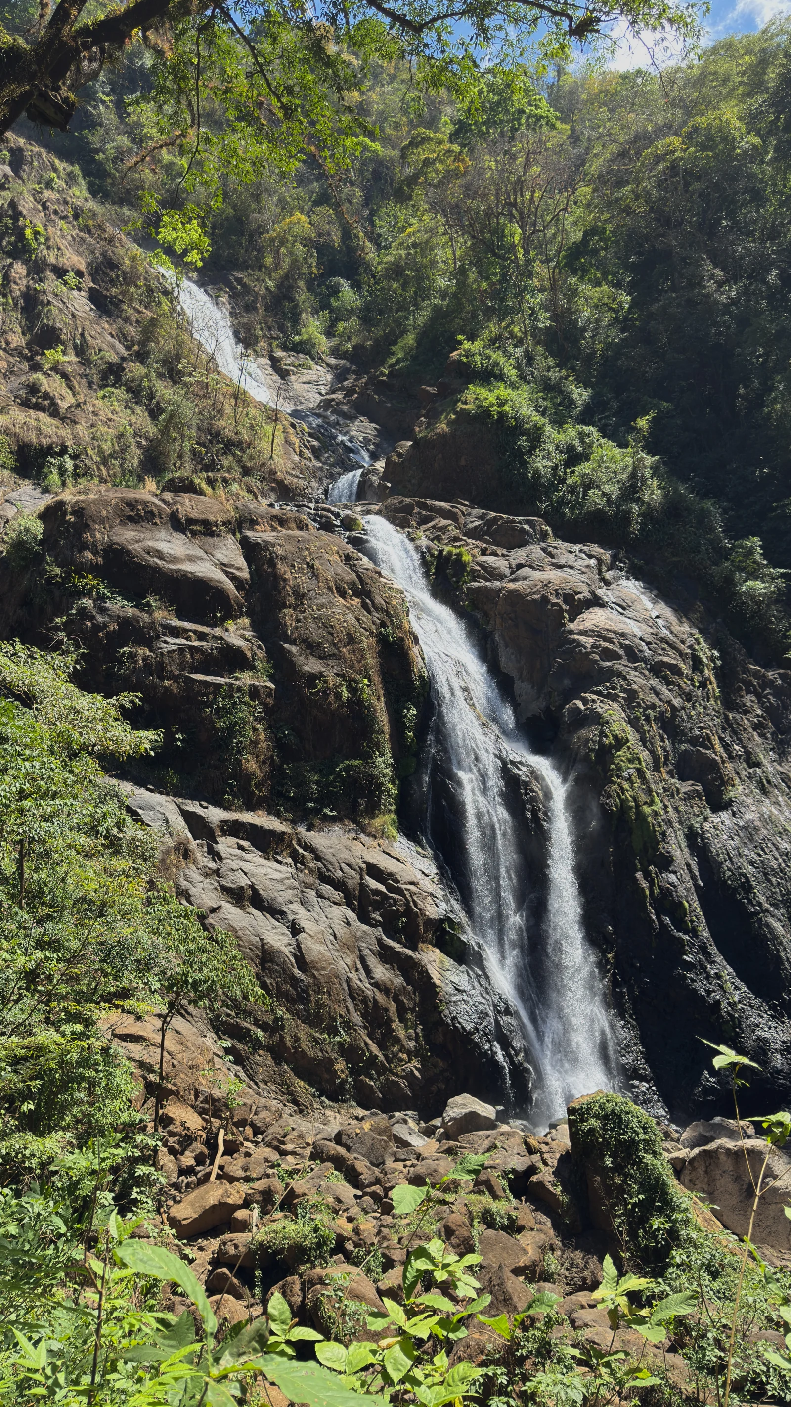
- A large mountain waterfall surrounded by tropical forest in the Carara biological corridor.
- Hiking and horseback options managed by local operators.
- Surrounding habitat where scarlet macaws, monkeys, toucans and other Central Pacific wildlife may be observed.
How to plan the visit
- Book directly with the administration and confirm the meeting point, tour format and duration.
- Ask about trail difficulty and disclose any physical limitations in advance.
- Start early and carry water, insect repellent, rain protection and hiking shoes.
Access and transport
The waterfall lies inland in the Bijagual and Carara area of the Central Pacific. Do not improvise the final approach from an app route: confirm directions, parking and the starting point with the authorized operator.
Trail and conditions
The hiking route crosses private forest, slopes, rivers and surfaces that become slippery. Distance and format depend on the booked tour; rainfall may increase difficulty or alter the itinerary.
Water and safety
Do not use informal access or attempt the route without coordination. Follow the guide, remain on the trail, avoid wet walls and unauthorized pools, and turn back when flow, storms or fitness make continuing unsafe.
On-site signs, staff and official closures always take precedence over this guide.Responsible visit
Booking through formal channels supports local guides and conservation. Never feed wildlife or remove plants; carry a reusable bottle and take every piece of waste out.
How to understand this waterfall
Also called Manantial de Agua Viva in some contexts, this fall descends a forested mountain near Carara. Its long visual profile does not mean roadside access.
The route crosses private property and rainforest. Formal visits protect access, prevent getting lost and define whether a tour reaches viewpoints, base or river sectors under current weather.
Practical plan
- Recommended time
- Half a day or more depending on tour
- Best base
- Jacó, Herradura, Carara or Bijagual de Turrubares
- Actual effort
- Moderate to high: rainforest, slope and crossings
- Swimming
- Only in authorized sectors when included
Step-by-step route
Meeting and registration
Private property · advance bookingConfirm exact point, transport, guide, distance and equipment. Do not confuse this site with Bijagua, Río Celeste or similar names.
Forest and descent
Slope · mud · variable durationPace from the start because return may be uphill. Rain quickly transforms soil and crossings.
Viewpoints and water sector
According to booked tourUse only guide-approved platforms and routes. Height and wet rock make independent approaches dangerous.
What to combine nearby
Carara and Tárcoles
Transition forest and river offer different experiences; schedule them in separate blocks or days.
Jacó and Herradura
Service and lodging bases for coordinated mountain outings.
Questions before leaving
Can I visit without a guide?
The described route operates on private property through authorized outings. Never enter independently.
How many kilometres are walked?
It depends on the booked tour and access. Request total distance, elevation and duration before paying.
Why does the image look much taller than others?
The fall follows a long slope and vertical photography emphasizes scale. The guide crops its cover for visual consistency, not to alter the place.
Editorial review: August 3, 2026. Opening, flow, access and swimming areas may change; reconfirm with the responsible operator.