
Planning data
Practical visit facts
- Route or distance
- Distance and format vary between hiking, internal transport and operator.
- Suggested time
- 3–5 hours.
- Admission and booking
- Private property; book through your chosen access or operator.
- Available facilities
- Services are concentrated at reception; confirm what the fee includes.
Distances, hours, access and facilities may change because of weather, maintenance or operating decisions. Always confirm with the official source before leaving.
Content reviewed on July 28, 2026What you will find
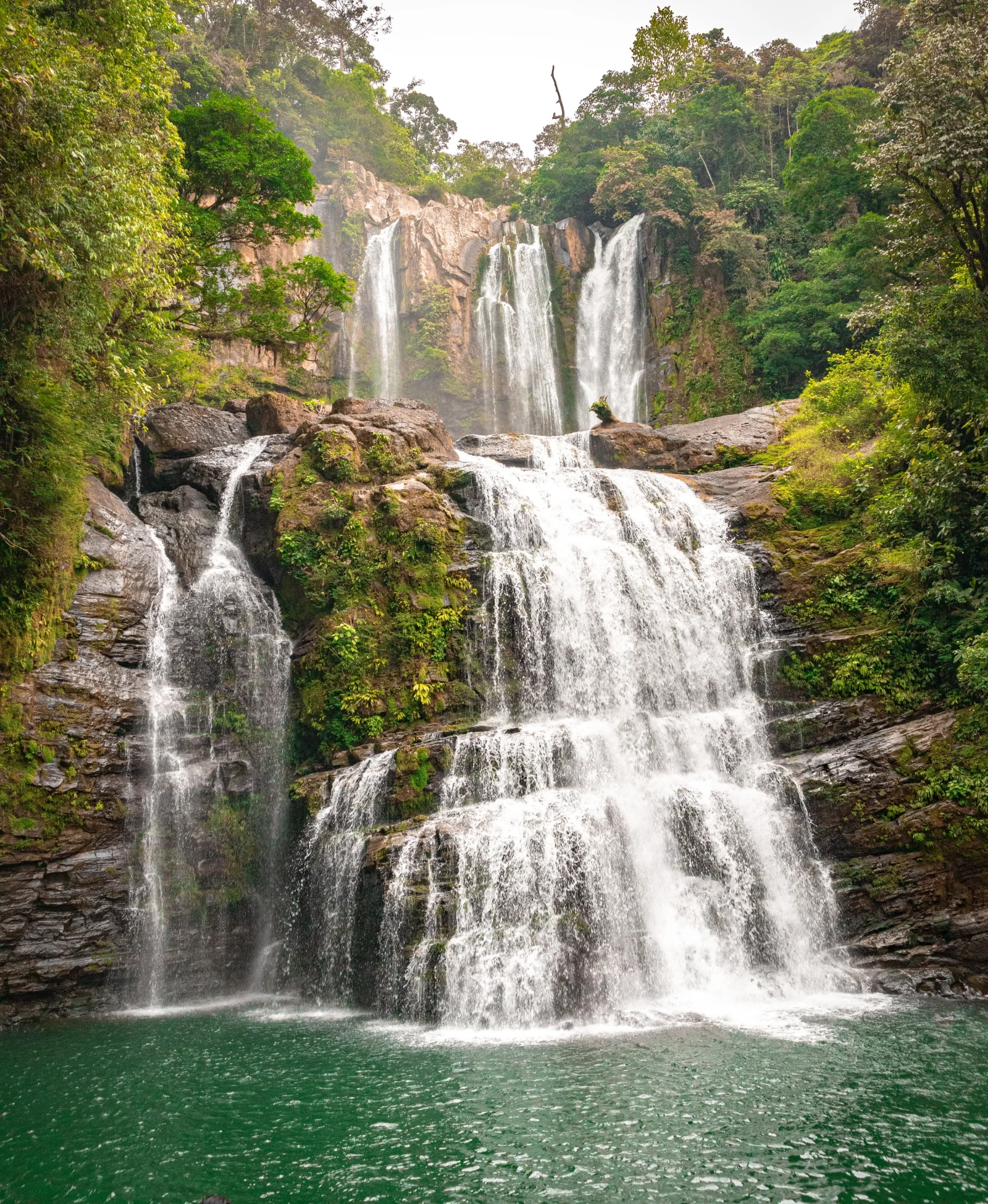
- Scenic upper and lower waterfall complex.
- Humid forest and natural pool at the lower tier.
- Access choices that shorten or lengthen the walk.
How to plan the visit
- Book directly with the operator and verify the entrance point.
- Choose a modality based on fitness, heat and available time.
- Start early and confirm the return time for arranged transport.
Access and transport
The entrance lies along the road between Dominical and San Isidro de El General. Similar names used by entrances or operators do not necessarily mean the same route.
Trail and conditions
The hike can be long, hot and hilly; rain brings mud and stronger flow. The experience varies substantially with the selected modality.
Water and safety
Do not jump from rocks or swim during high flow. Wet stone is slippery and pool depth can change abruptly.
On-site signs, staff and official closures always take precedence over this guide.Responsible visit
Use authorized trails and services, leave no waste and avoid applying sunscreen or repellent immediately before entering the water.
How to understand this waterfall
Nauyaca has two tiers: the upper fall provides scale and force, while the lower creates the visual amphitheatre and better-known pools. Treating them as one wall hides their differences.
Similar operator and entrance names can cause confusion. Distance, 4×4 transport and timing are not universal; they depend on the exact company and product booked.
Practical plan
- Recommended time
- Half a day; longer when walking the full approach
- Best base
- Dominical, Uvita or San Isidro de El General
- Actual effort
- Variable by booked entrance and format
- Swimming
- Only in indicated areas under safe flow
Step-by-step route
Entrance and transfer
Hike or arranged transportConfirm location, parking, deadline and format before driving. Never assume one booking works at every entrance.
Upper tier
Observation · exposed rockUse designated points; strong water and wet surfaces make climbing or approaching edges unsafe.
Lower tier
Pools and rest when flow permitsUse indicated areas, assess depth and never jump. The exit may still involve a long walk or scheduled transport.
What to combine nearby
Dominical and Barú
Beach, forest and valley support a multi-night stay; avoid pairing the waterfall with a long transfer that day.
San Isidro de El General
Useful service and road base when continuing into the mountains or south.
Questions before leaving
How far is the walk?
It depends on the booked access. One official option advertises a 2.7 km trail and 4×4 transfer, but other formats vary—check your confirmation.
Can I arrive without booking?
Do not rely on it. A booking defines entrance, format, timing and return, and prevents driving to the wrong point.
Is it a short activity?
Not always. Transfers, elevation, heat, pool time and return can occupy much of the day.
Editorial review: August 3, 2026. Opening, flow, access and swimming areas may change; reconfirm with the responsible operator.