
Planning data
Practical visit facts
- Route or distance
- Misterios del Tenorio trail: 3 km each way, 6 km round trip.
- Suggested time
- Approximately 3 hours.
- Admission and booking
- Purchase only through SINAC’s official system.
- Available facilities
- Drinking water and toilets; private parking costs extra.
Distances, hours, access and facilities may change because of weather, maintenance or operating decisions. Always confirm with the official source before leaving.
Content reviewed on July 28, 2026What you will find
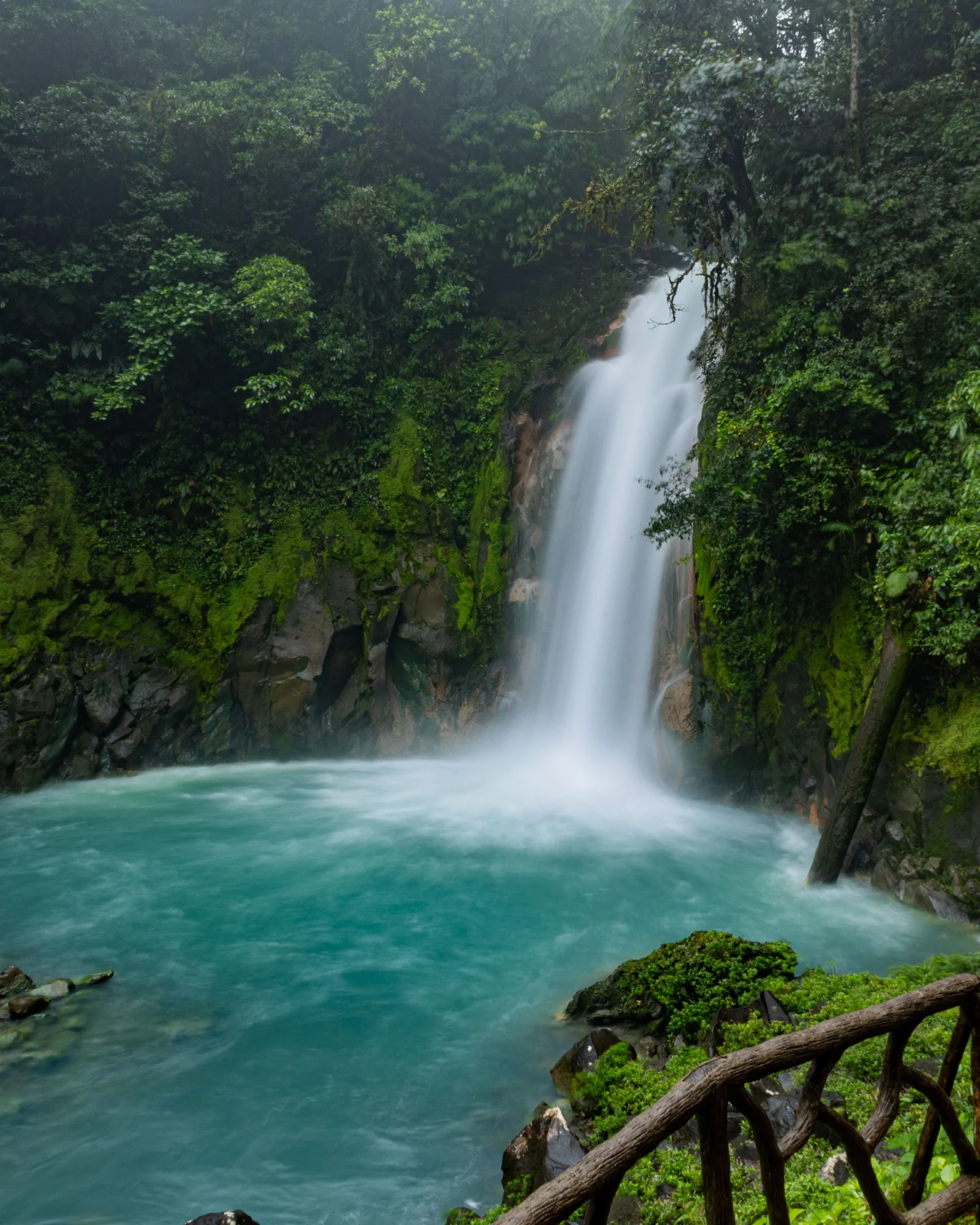
- Viewpoint over a drop of approximately 20 metres.
- Very humid forest and the Río Celeste geological route.
- Access inside a protected area managed by SINAC.
How to plan the visit
- Buy admission only through SINAC’s official system.
- Check closures, rain and trail status before driving to the park.
- Carry rainwear, water and closed shoes with good grip.
Access and transport
The visitor entrance is near El Pilón, reached from Bijagua via Route 6 and the Río Celeste road. Do not confuse the park with private accesses or swimming sites in the area.
Trail and conditions
The full route can approach 6 km when every section is open. Expect mud, roots and stairs; rain can reduce the visible intensity of the colour.
Water and safety
Swimming is prohibited inside the park. Do not touch bubbling springs, cross barriers or ignore closures caused by floods, gases or trail damage.
On-site signs, staff and official closures always take precedence over this guide.Responsible visit
Remain on trails, bring no pets or drones and follow protected-area rules, including restrictions on single-use plastics.
How to understand this waterfall
The colour comes from neither paint nor a substance that is inherently blue. At Teñidero, waters with different characteristics mix and suspended mineral particles scatter light to make the turquoise colour visible.
The waterfall is one stop in a larger system: rainforest, lagoon, bubbling springs and Teñidero form a geological route. Visiting only for a photograph removes most of the river story.
Practical plan
- Recommended time
- 2 to 4 hours depending on open sections
- Best base
- Bijagua
- Actual effort
- Moderate: up to roughly 6 km with mud, roots and stairs
- Swimming
- Prohibited inside Tenorio Volcano National Park
Step-by-step route
Waterfall
Stair detour · roughly 20 m dropThe viewpoint requires descending steps that must be climbed again. Visible intensity varies with light, rain and sediment.
Lagoon and bubbling springs
Wet trail · never touch waterObserve gases and hydrothermal activity from the route. Cross no barriers and keep hands out of the water.
Teñidero
Geological interpretation pointThis is where the optical phenomenon becomes clearest. Attempt the full route only while every section is open.
What to combine nearby
Bijagua
Base for lodging, food and transport, and for separating the park from private swimming areas.
Caño Negro and Northern Zone
Wetlands and rural communities complement Tenorio forest on another day.
Questions before leaving
Does rain remove the colour?
It may reduce visible intensity through sediment and light changes, but the phenomenon is not artificial dye.
Can I swim at the waterfall?
No. SINAC prohibits swimming inside the park. Do not confuse the official trail with private external properties.
Is the route always 6 km?
That is a reference when every section is available. Weather, gases or damage may shorten it.
Editorial review: August 3, 2026. Opening, flow, access and swimming areas may change; reconfirm with the responsible operator.